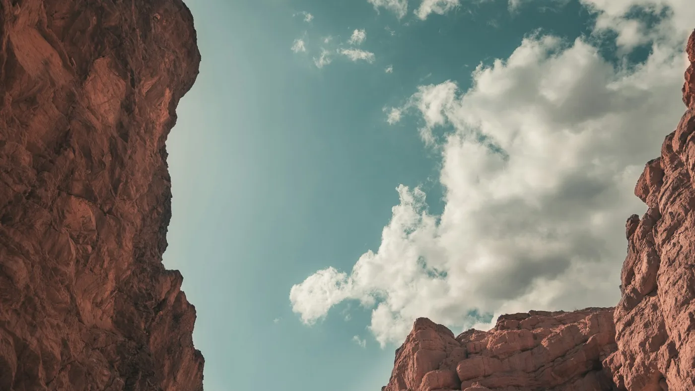
You're thirty minutes from a private pool in Palm Springs, standing in a canyon so thick with native fan palms that the desert on either side disappears. The creek is running. The fronds are rattling. Somewhere overhead, the San Jacinto range climbs from here to 10,834 feet. You had no idea any of this was available to you an hour ago.
Hiking near Palm Springs is one of those things that surprises people who showed up for the pools and the architecture. The mountains are right there, and the canyons cut into them hold palm oases, seasonal waterfalls, and trails that feel nothing like the flat Mojave scrub around them. October through April is the window. Summer requires a 5am start and a serious conversation with yourself about heat.
Here are eight trails worth knowing, with real stats so you can plan before you drive.
| Region | Palm Springs / Coachella Valley, CA |
|---|---|
| Best Season | November–April (avoid June–September heat) |
| Closest Property | The Sundune, Palm Springs |
| Entry Fees | Indian Canyons $12/person, Tahquitz Canyon $15/person, tram $32 |
| Dog Friendly | Lykken Trail, Bump and Grind — leash required |
Quick Comparison: All 8 Trails
| Trail | Difficulty | Distance | Elev. Gain | Fee | Dogs |
|---|---|---|---|---|---|
| Andreas Canyon | Easy | 1.2 mi loop | 177 ft | $12/adult | No |
| Palm Canyon | Easy-Moderate | ~4 mi out-back | 226 ft | $12/adult | No |
| Murray Canyon | Moderate | 3.7 mi out-back | 450 ft | $12/adult | No |
| Tahquitz Canyon | Moderate | 2.0 mi loop | 321 ft | $15/adult | No |
| North Lykken Trail | Hard | 4.5 mi out-back | 1,755 ft | Free | Yes (leash) |
| Bump and Grind | Moderate | 4.1 mi loop | 1,105 ft | Free | No |
| Desert View (Tram) | Easy | 1.5 mi loop | ~200 ft | $37/adult (tram) | No |
| San Jacinto Peak (Tram) | Strenuous | 11 mi out-back | 2,620 ft | $37/adult (tram) + free permit | No |
The desert is not uniformly dry. Getting out before 8am in the canyons is the whole strategy.
1. Andreas Canyon (Easy)
Andreas Canyon is the quieter, flatter entry point into the Indian Canyons system. The loop follows a creek through a grove of California fan palms, the world's second-largest native fan palm oasis, and the contrast between the open desert at the parking area and the shaded creek bed inside the canyon is immediate and real. You go from scrub and heat to cool green in about five minutes of walking.
The trail stays mostly level and takes under an hour at a comfortable pace. It's the right pick for families with kids, anyone who wants a taste of the canyons without committing to distance, or a warm-up before the longer Palm Canyon loop. The smooth creek stones underfoot require attention but nothing technical. Open October through May daily; summer hours are Friday through Sunday only.
Andreas Canyon on AllTrails | Indian Canyons official site
2. Palm Canyon (Easy to Moderate)
Palm Canyon is the most visited trail in the area, and the popularity tracks with the payoff. The canyon holds one of the largest native California fan palm oases in the world: thousands of palms lining a creek bed, the trunks charcoal-grey and skirt-draped, the fronds overhead blocking out the sky in sections. The trail descends from the trailhead trading post down into the canyon floor and the scale of it only becomes clear once you're inside.
Plan 2 to 3 hours for a comfortable out-and-back that reaches far enough to feel the canyon open up. The trail continues much further for those who want more mileage. Go before 10am if you're visiting in spring: the light comes into the canyon at a low angle and the temperature is still in the 70s. Afternoon in late March means 90+ degrees and shadow-free stretches on the return.
This is part of the Indian Canyons on Agua Caliente Tribal Land. The entry fee goes to the tribe. Palm Canyon Trail on AllTrails.
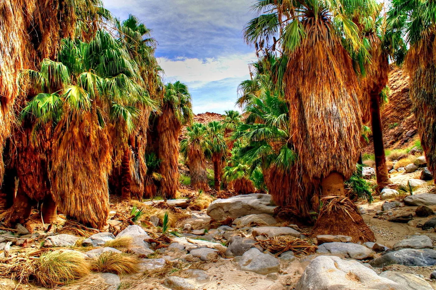
Inside Palm Canyon: thousands of native fan palms line the creek bed, the trunks charcoal grey and skirt-draped. The scale only becomes clear once you are inside.
3. Murray Canyon and the Seven Sisters Waterfall (Moderate)
Murray Canyon is one canyon over from Palm Canyon and the less-crowded version of the Indian Canyons experience. The trail winds through a palm oasis and builds to the Seven Sisters: a series of stair-step cascade falls that tumble down the canyon walls, pooling at the bottom in a shallow basin where you can wade in wet months. In a good rain year, January through April is when the falls run strongest.
The canyon walls close in as you get deeper, which is the point. The last stretch before the falls is rockier and requires some scrambling over boulders. Plan 2.5 to 3 hours and wear shoes with actual grip. The same Indian Canyons entry fee covers both Murray and Palm Canyon if you visit on the same day. Murray Canyon on AllTrails.
All of these trailheads are within 20 minutes of The Sundune in Palm Springs. Early morning starts are easier when you're already in the desert. Check availability →
4. Tahquitz Canyon (Moderate, Guided)
Tahquitz Canyon is a separate canyon system on Agua Caliente land, with its own entry point, its own ticket ($15/person), and a different feel from Indian Canyons entirely. You access it from 500 W Mesquite Ave in Palm Springs, not from the Indian Canyons tollgate south of downtown. These are not the same place and they don't share a ticket.
The trail is a 2-mile loop with about 350 feet of elevation gain. Most of it is pretty flat, with one rocky section near the waterfall where you're picking your way up boulders. The destination is Tahquitz Falls, a 60-foot drop off smooth granite into a pool. It's one of the only year-round waterfalls in the Coachella Valley. In a wet winter, the pool runs clear and the falls are going hard by February. In a dry year, it slows to a curtain of mist by April. The canyon itself, with Cahuilla rock art and old irrigation channels along the trail, is worth the trip either way.
Ranger-led tours run twice daily at 9am and noon. Self-guided entry is also available if you'd rather go at your own pace. The canyon uses timed entry, so reservations are recommended in winter and spring when it fills up. Check the Tahquitz Canyon website for current times and booking. Open daily October through early July; weekend-only in summer.
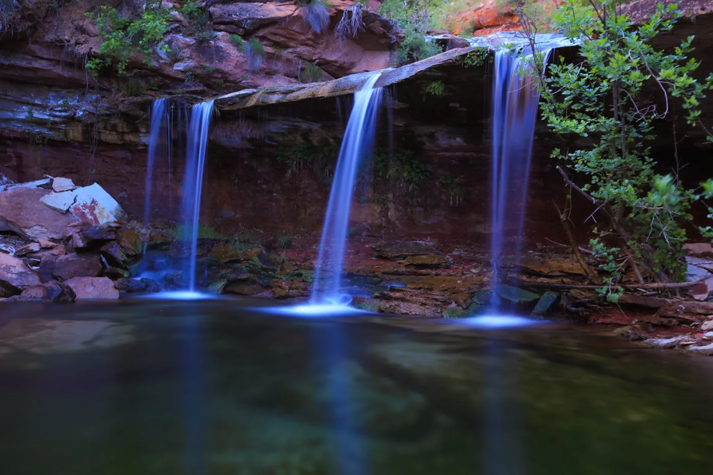
Tahquitz Falls drops 60 feet off a smooth granite face into a pool below. In a wet winter it runs hard from February onward. In a dry year it slows to a curtain of mist by April.
5. North Lykken Trail (Hard)
The Lykken Trail is the city hike of Palm Springs: it starts from a free parking lot at the end of Ramon Road and climbs the ridge directly above downtown. The urban grid falls away fast. By the first major switchback, you're high enough to see the full valley spread south: the Salton Sea on a clear day, the Santa Rosa Mountains to the east, and the row of Palm Springs pools glinting below. The San Jacinto wall rises above you to the west, close enough to feel like a separate weather system.
At 1,755 feet of elevation gain over 4.5 miles, this is a real workout and genuinely hard in warm weather. The trail connects to the Museum Trail for additional route options, and you can link up with the South Lykken for a longer ridge traverse. Dogs are allowed on leash, which makes this the best free dog-friendly hike close to downtown Palm Springs. Start by 7am in spring. North Lykken on AllTrails.
6. Bump and Grind Trail (Moderate)
Bump and Grind is a local favorite in Palm Desert, about 20 minutes east of Palm Springs. The trailhead is behind a Target on Painters Path, which tells you nothing about what the trail delivers: a 4.1-mile loop that climbs 1,100 feet up into the Santa Rosa Mountains and gives you a panoramic view of the entire valley floor. The Salton Sea sits at the far end. The desert cities line up below. On cold mornings, the Coachella Valley fog collects in the lower elevations and you're above it.
The trail is well-maintained with good signage throughout the loop. Plan 2 to 2.5 hours. Go early: the exposed ridge section heats up fast once the sun hits. This is one of the better free hikes in the area with real elevation and real views. Bump and Grind on AllTrails.
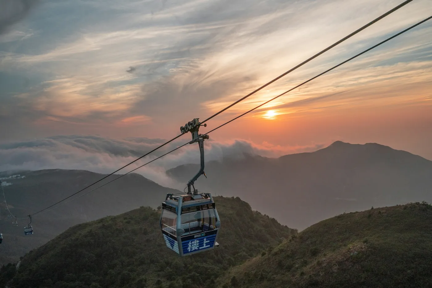
The tram makes the alpine elevation accessible to anyone. The hiking above the tram station is another story entirely.
7. Desert View Trail at the Tram (Easy)
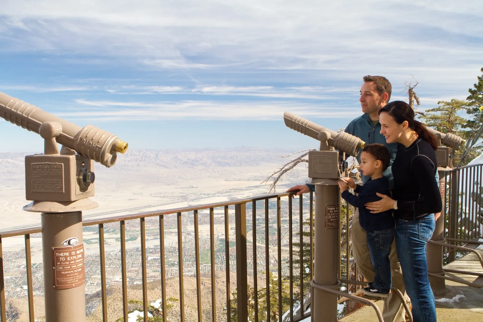
The Palm Springs Aerial Tramway takes you from the desert floor at 2,643 feet to Mountain Station at 8,516 feet in 10 minutes. The tram cars rotate slowly on the way up, and at some point you go from saguaro and scrub to granite walls streaked with snowmelt to ponderosa pine. The altitude change is more than most flights. The Desert View Trail at the top is an easy loop from the station with views down into the Coachella Valley and across the San Jacinto Wilderness.
This is the right option for people who want the high-altitude experience without the physical effort. The air at 8,500 feet is noticeably thinner and noticeably cooler: bring a layer even in May. Tram tickets run around $37 per adult. First tram up is typically 10am on weekdays, 8am on weekends; check the tram site for current schedules. The tram itself is the experience. The hiking is a bonus.
8. San Jacinto Peak via the Tram (Strenuous)
The summit of San Jacinto Peak sits at 10,834 feet. Taking the tram cuts roughly 6,000 feet of climbing off the bottom, but the 11-mile out-and-back from Mountain Station still gains 2,620 feet through a San Bernardino National Forest wilderness. The trail moves through pine forest, past exposed granite, and above treeline before the final push to the summit cairn. The view from the top looks straight down at the Palm Springs valley floor, 8,000 feet below.
Plan 6 to 8 hours total including tram time. Free wilderness permits are required and available from the ranger station at Mountain Station. Take one of the first trams up and be back at Mountain Station at least an hour before the last tram down. Weather changes fast above 9,000 feet, particularly in spring. Snow is possible on the summit into May. This is a legitimate backcountry day. Don't do it in trail runners without checking conditions first. San Jacinto Peak on AllTrails.
Early tram means early summit. The first clear morning after a rainstorm is the one worth waiting for.
When to Go
October through April is the hiking window. This is when temperatures at trail level are comfortable, the canyons have the best chance of water running, and the desert is at its most alive. February and March are the sweet spot: wildflowers in some years, cool mornings, long enough days to do a full canyon and still make brunch.
May and September are shoulder months. Possible, but warm. Go before 8am on any trail with real elevation, before 7am in May.
June through August: genuinely dangerous on exposed trails for most people. The temperature rise between 6am and 9am in canyon bottoms can be 20 degrees. Many locals skip hiking entirely in summer and use pools instead. If you go, 5am is not a suggestion. Andreas Canyon and the tram hikes are the most viable summer options.
What to Bring
Water: more than you think. A full liter per person minimum. For half-day hikes, two liters. Desert sun and dry air pull moisture out faster than you'd expect, and the canyons give you a false sense of shade on the way in.
Sun protection: wide-brim hat, SPF 50+, UV-blocking sunglasses. Even in shade, reflected light off canyon walls is significant.
Shoes with actual grip: the canyon floors are boulder-strewn in sections. Trail runners work. Sandals do not.
A layer for the tram and summit hikes: Mountain Station at 8,516 feet runs 30 to 40 degrees cooler than the valley floor. Bring a fleece even in April.
For everything else you might need for a desert day, the full packing list is in the desert vacation prep guide. It covers scheduling your day around the heat, what to eat before, and what to keep in the car for the return.
Start before 7am in spring and you get this: cool air, long shadows, and the whole valley laid out below you before the heat sets in.
Where to Stay for Easy Trail Access
The Indian Canyons, Tahquitz Canyon, and the Lykken Trail are all within 10 minutes of central Palm Springs. The tram is 15 minutes from downtown. Bump and Grind is 20 minutes east in Palm Desert.
If you're basing yourself for a hiking trip, The Sundune in Palm Springs puts you closest to the mountain trails. If you want space to come back to after a hard morning, The Cozy Cactus in Indio has a private hot tub and pool. Both are under 30 minutes from every trail on this list. If you're bringing your dog, see the pet-friendly Palm Springs guide for which trails and properties work for dogs.
Frequently Asked Questions
What is the easiest hike in Palm Springs?
Andreas Canyon in the Indian Canyons is the easiest pick: a 1.2-mile loop with only 177 feet of gain, through a palm oasis along a seasonal creek. Under an hour at any pace. The $12 Indian Canyons entry fee applies.
Which Palm Springs hikes have waterfalls?
Two. Murray Canyon leads to the Seven Sisters, a stair-step cascade series that runs strongest from January through April. Tahquitz Canyon ends at a 60-foot waterfall off smooth granite. Both are on Agua Caliente land with separate fees ($12 and $15 respectively).
Can you bring dogs on Palm Springs hiking trails?
Most popular trails don't allow dogs. Indian Canyons, Tahquitz Canyon, Bump and Grind, and the tram/San Jacinto wilderness all prohibit dogs. The North Lykken Trail is the best free dog-friendly option close to downtown, leash required. See the full pet-friendly Palm Springs guide for lodging and trails that work with dogs.
What is the best hike near Palm Springs for beginners?
Andreas Canyon for anyone who wants short and rewarding. Palm Canyon for beginners who want more distance without technical terrain. Both use the same $12 Indian Canyons entry. Go in the morning, October through April.
Can you hike in Palm Springs in summer?
Yes, but you need a 5am start and heat management. Canyon floors hit 110°F+ by mid-morning in summer. The tram hike is the most viable summer option since Mountain Station at 8,516 feet runs 30 to 40 degrees cooler than the valley floor. Most experienced desert hikers skip trail hiking in summer entirely.
How hard is the hike to San Jacinto Peak from the tram?
It's 11 miles out-and-back with 2,620 feet of elevation gain starting at 8,516 feet. Strenuous, 6 to 8 hours total, free wilderness permit required. Take the first tram up. Snow is possible on the summit into May. Not for casual hikers without conditioning or appropriate gear.